
Explainable
Recommendations show supporting factors, assumptions, confidence, and uncertainty.

HUNTINTEL TERRAIN INTELLIGENCE ENGINE
HuntIntel LLC develops explainable terrain intelligence technologies that transform complex geospatial data into mission-specific decision support.
A New Category
Maps show where things are. Terrain intelligence explains what the terrain means for a specific mission: its opportunities, constraints, risks, and alternatives.
Elevation, vegetation, hydrology, movement, weather, and infrastructure.
Explainable models evaluate terrain against mission-specific objectives.
Recommendations surface constraints, opportunities, risk, and alternatives.

Emerging Technology
HTIE is an emerging, explainable terrain-reasoning platform designed to integrate elevation, vegetation, hydrology, transportation, weather, and other geospatial data into transparent mission recommendations.
HTIE is under active development. Current HuntIntel products use commercial AI services and proprietary workflows while HuntIntel develops an increasingly independent terrain-intelligence engine.
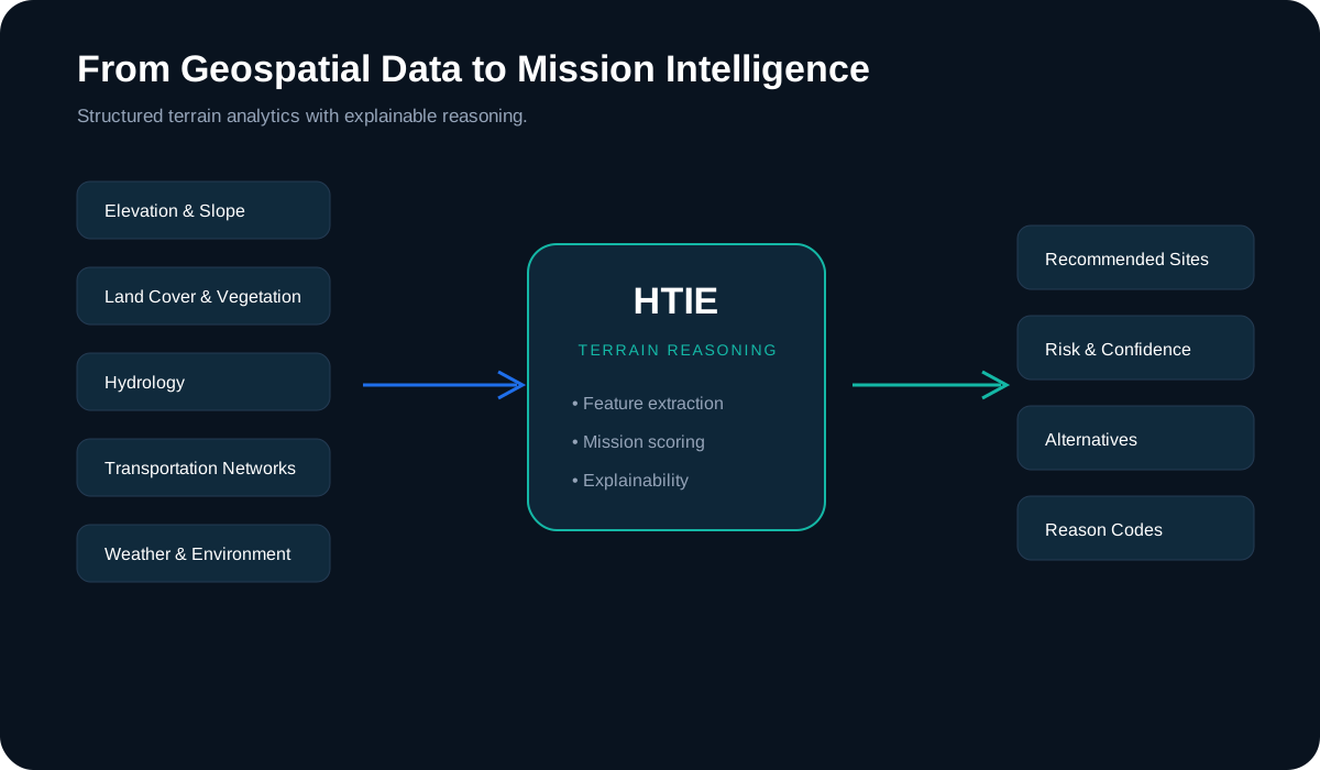
Calm, explainable terrain reasoning designed to keep trained decision-makers in command.
Recommendations show supporting factors, assumptions, confidence, and uncertainty.
Configurable mission models evaluate the same terrain differently for different operational objectives.
HTIE supports trained decision-makers; it does not replace operational judgment.
The architecture is designed to evolve from commercial cloud deployment toward private and disconnected environments.
Mission Models
Personnel Recovery is featured as a representative mission model. Government mission models described here are potential applications, not fielded products.
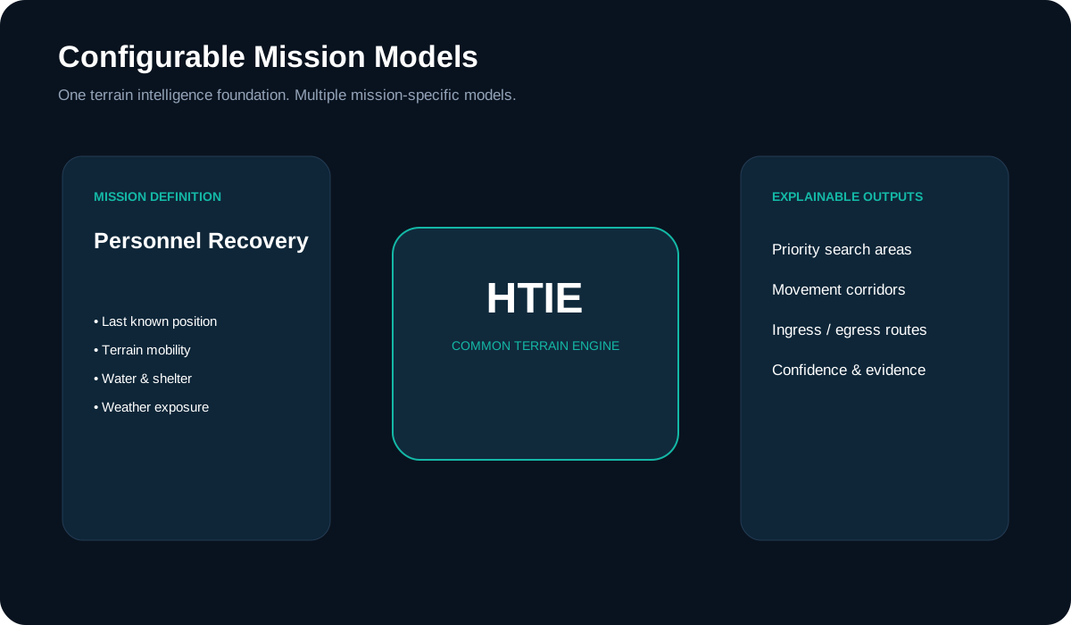
HuntIntel applies terrain intelligence concepts across commercial outdoor tools and emerging mission-support applications.
Potential applications include personnel recovery, site assessment, mobility, visibility, communications, and mission planning.
Designed to support search and rescue, emergency response, wildfire support, and incident planning workflows.
Commercially deployed terrain tools for hunters, landowners, and hunting organizations.
Future applications may include routing, siting, risk assessment, and environmental planning.
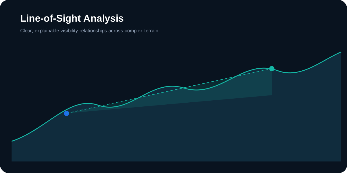
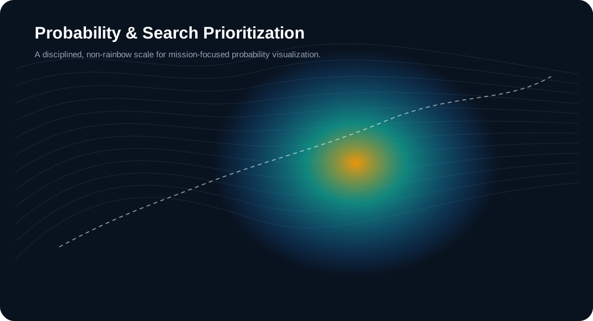
Representative HTIE Visualization Concepts
These graphics illustrate concept directions for explainable terrain outputs as HTIE continues development.
HuntIntel LLC was founded in Huntsville, Alabama by Neal Farmer, a U.S. Air Force veteran and technology specialist with more than twenty years supporting U.S. government and Department of Defense programs in intelligence, software engineering, cloud computing, cybersecurity, command-and-control integration, and systems architecture.
UEI
CAGE
Contact
For corporate, research, or mission-support discussions, contact Neal Farmer in Huntsville, Alabama.